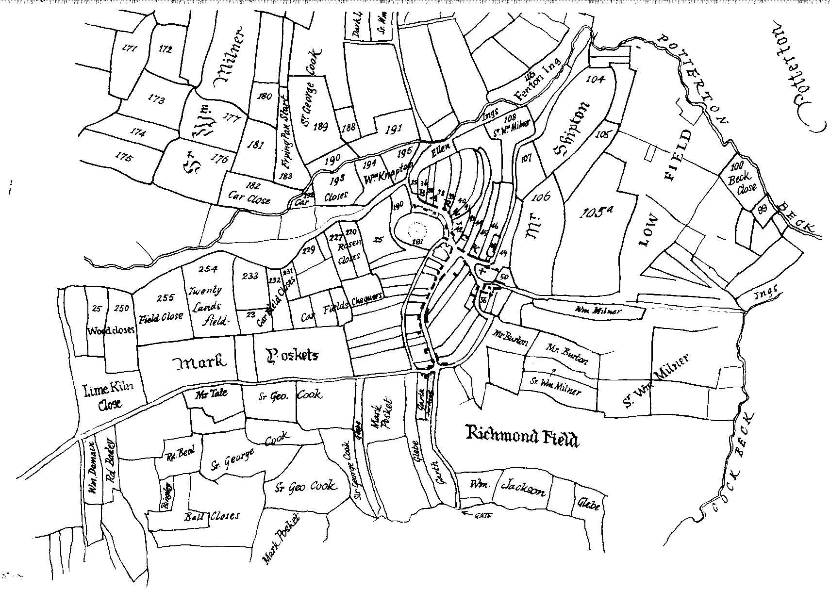
Barwick-in-Elmet
1772
|
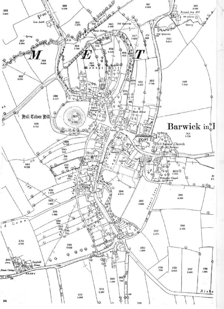
Barwick-in-Elmet
1892
|
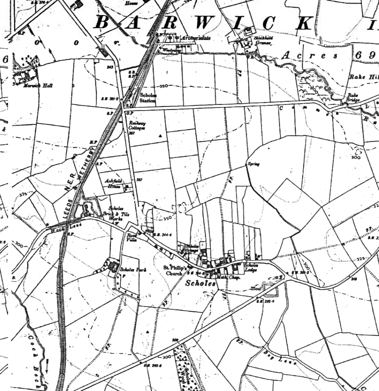
Scholes in Victorian Times
|
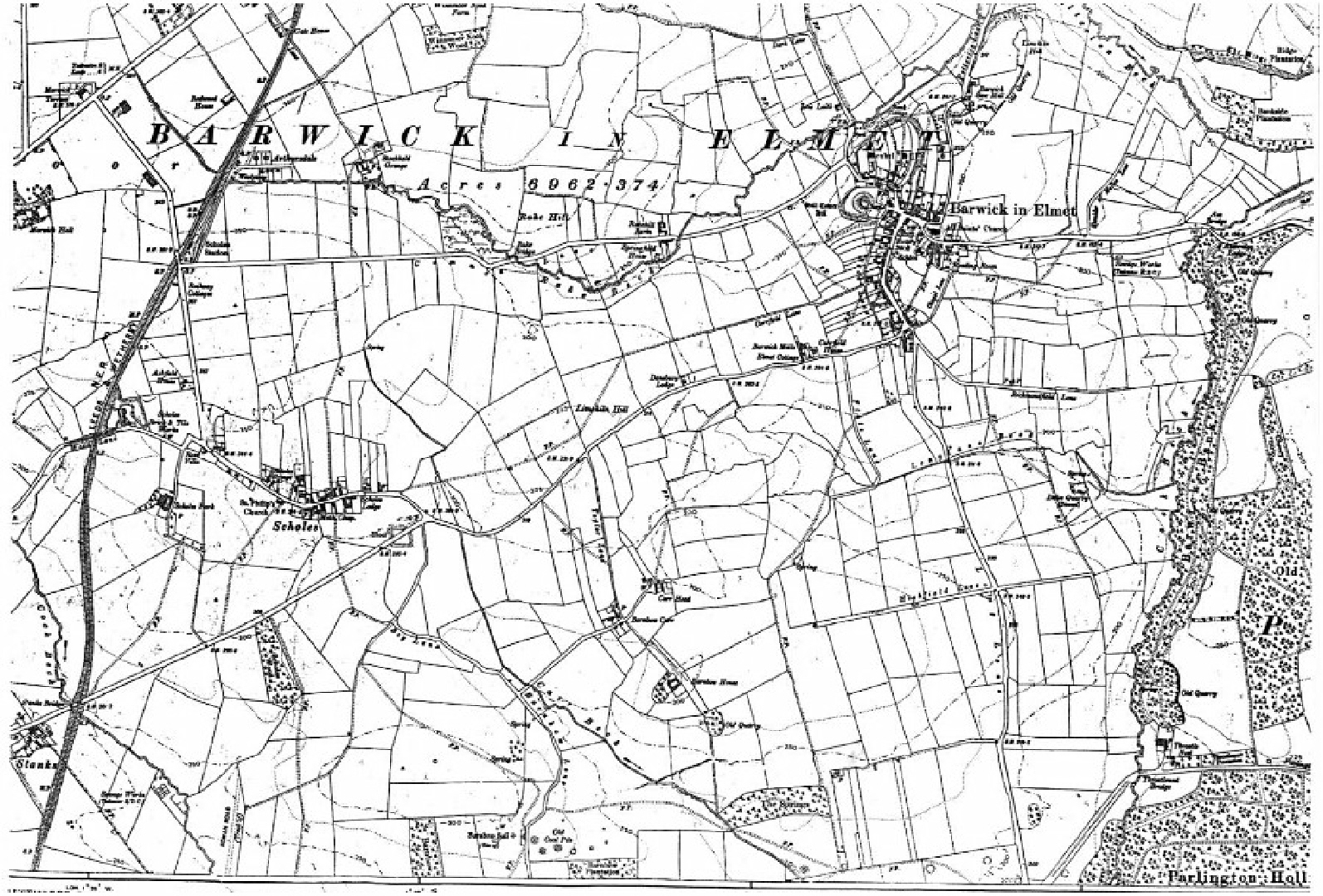
Late Victorian Barwick-in-Elmet & Scholes
(1892 with revisions up to 1906)
|
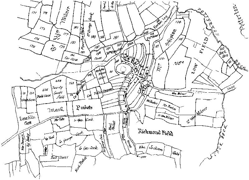
| This is the oldest known map of the township of Barwick-in-Elmet.
It is part of a larger map covering the whole of Barwick-in-Elmet and Scholes.
Its main purpose is to show the disposition and ownership of agricultural
land. However it provides us with valuable information on road layouts
and housing. |
Being a large scale map, it is possible to see the village
in depth at the close of the last century before the car made its impact
and turned the village in which farming was the dominant influence to one
where commuting to work in nearby Leeds dominates the economy of the village.
There were a few residents in 1892 who worked or attended Secondary School
in Leeds. They faced a two mile walk along Rakehill Road (a green lane)
to Scholes Station to achieve this. |
The village is shown in great detail at the close of the
last century. The railway had become established in 1876. It was influential
in expanding the village by enabling residents to commute by train to work
in nearby Leeds.
Note the first 'modern' houses springing up in Arthursdale
to the north of the railway station. |
This map shows both villages at the close of the last century.
The parish is still largely agricultural. |
Larger Plan than above of the eastern part of the parish in 1772
Map
|
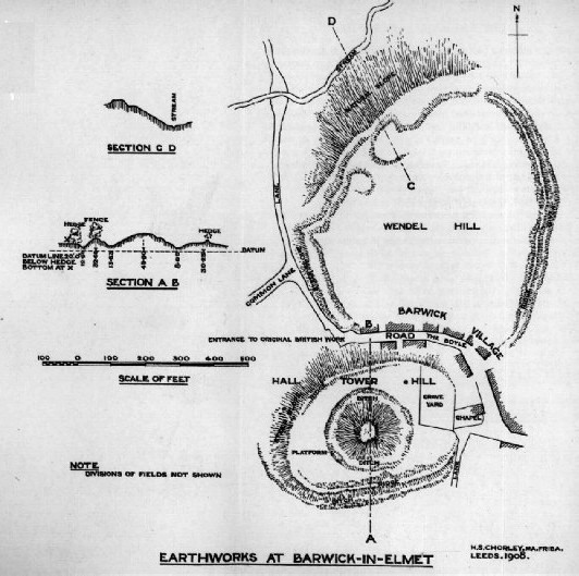
Plan of the earthworks at Barwick- in-Elmet
1908
|
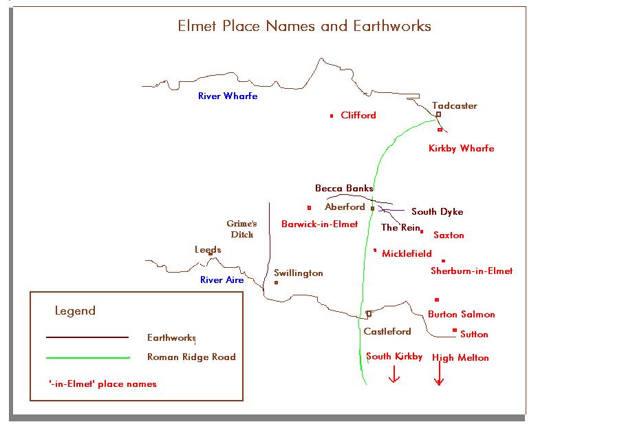
Saxon England
circa 600 A.D.
|
Elmet placenames and Earthworks
|
| This map shows from Taylor Lane in the west almost to the eastern parish boundary. |
This plan is from "A History of the Parish of Barwick-in-Elmet in
the County of York" by F.S. Colman pub. The Thoresby Society, Leeds
1908. The earthworks are essentially the same today. However, a revised
plan to show the earthworks as they are now will be available shortly. |
The map shows the approximate location of the Kingdom of Elmet and
other Saxon kingdoms prior to Viking invasion. |
The location of villages which have had at some time the ending "-in-Elmet"
are shown on the map. In addition the location of significant earthworks
close to Barwick-in-Elmet are shown. Recent archaeological investigation of Grime's
Ditch (or Grimesdyke)has revealed that this ditch dates from the Bronze Age (i.e. some 3000
years old). Becca Banks appears from recent investigation to have been hastily made in the
period when the area was conquered by the Romans. |
|
Map of the whole parish made at the turn of the century
Map
|
Part of the present day village of Barwick-in-Elmet.
Map |
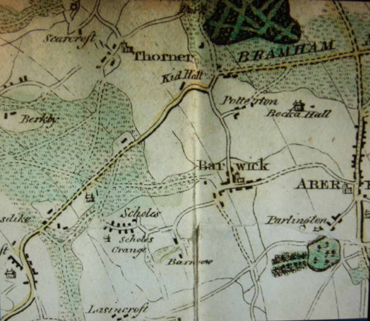
Map of most of the parish in circa 1797.
Map
|
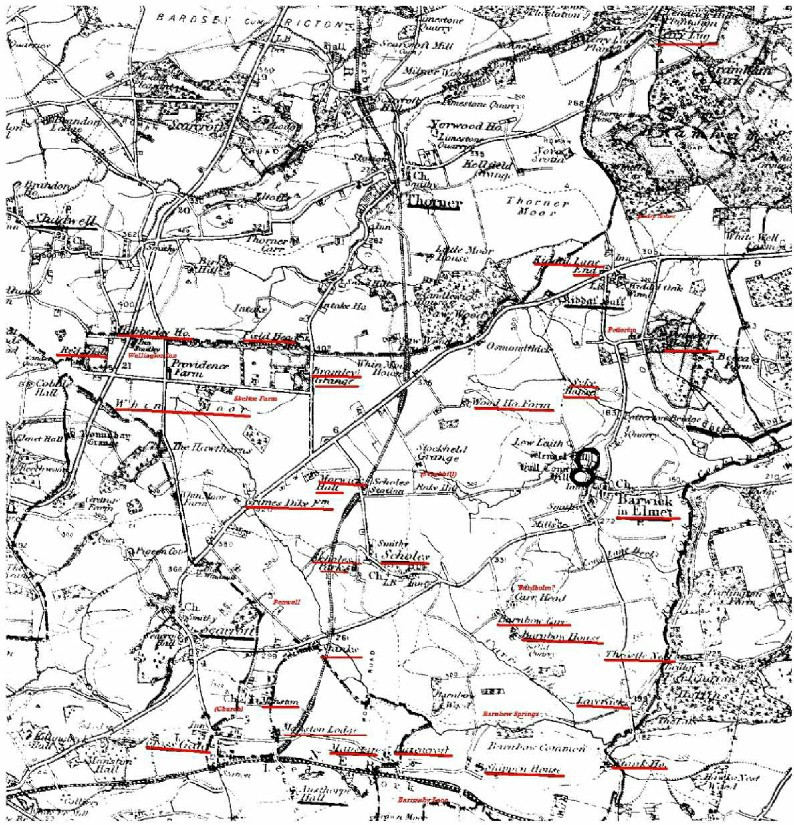
Part of the 1st Ordnance Survey Map of the parish in the 1840s.
Map |
| This map was adapted from an Ordnance Survey and can be found in "A History of the Parish of Barwick-in-Elmet in the County of York - F.S. Colman 1908" It shows the whole parish from Rounhay in the north-west and Crossgates in the south-west to Parlington Park in the south-east and Terry Lugg which is part of Bramham Park - yet still in the parish in the north-east. |
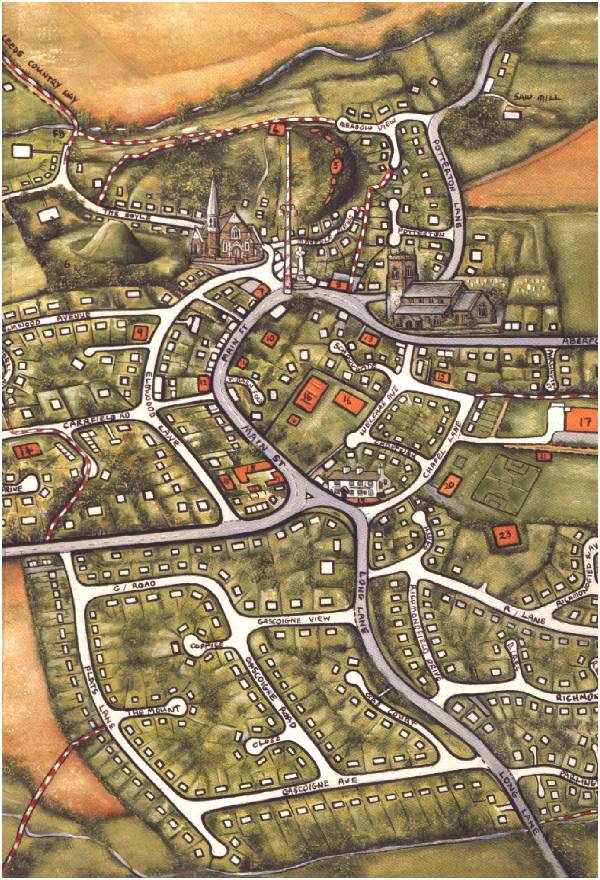
This map has been painted for the Historical Society by Carl Whitfield, a professional artist living in the village. The complete map covers the village and the surrounding countryside as far as the Scholes boundary in the west and the Leeds - York road (A64) in the north. It has been reproduced by the society in conjunction with a brief history of Barwick-in-Elmet village to mark the arrival of the year 2000. |
This map was published in a book published in c.1797 entitled "A History of Leeds", compiled from various authors. The map, showing the Barwick area is part of "A map of near 10 miles round Leeds" engraved by William Butterworth of Headingley (1769-1834) |
This map was retrieved from a barn where it had lain discarded for a long time. The society has had the document restored. Click on the map to enlarge it. |