Barwick-in-Elmet Historical Society
THE PARISH AS IT IS TODAY
From Aberford to Potterton
This information is provided by the Barwick-in-Elmet Historical Society.
BECCA BANKS
Running from near Potterton Bridge eastwards through Aberford and across the A1 motorway, Becca Banks mark the time when the
 area was an important place. Because of recent excavations carried out before the A1 was widened (in the late 1990's), it is possible to be more positive about the age and purpose of the banks. The earthworks are thought to have been built rather hastily as defences facing south about the time of the Roman invasion of the north of England. The banks probably were constructed up to 600 years after the earthworks in Barwick-in-Elmet. There does not appear to be any direct connection (either physically or by purpose) between the two sets of earthworks.
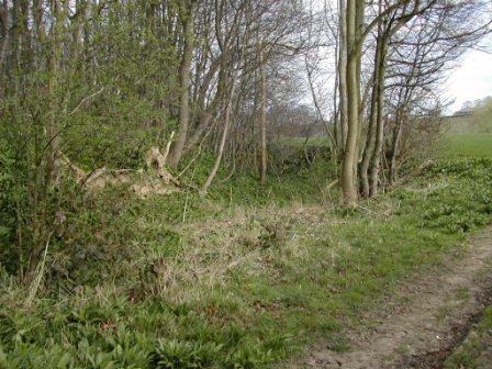
The view was taken (on 12th April 2002) to the north of Leyfield Farm where the defences are breached by a bridal path. Like the whole length of the banks, the features are heavily obscured by trees. The rising ground to the left of the picture is the defending bank. The depression in the centre is the defensive ditch. The barns of Leyfield Farm can be seen on the top right of the picture.
The intervening 2000 years has worn away some of the height of the
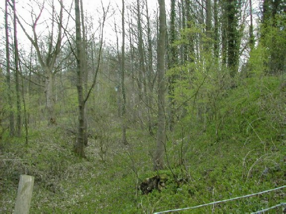 bank and partly filled in the ditch. Further east, closer to Aberford, the bank is even more pronounced as can be seen in this second view taken facing west. The bank rises steeply to the right of the photograph (taken on 13th April 2002). After some 100 metres to the east of the A1 it is more difficult to trace the bank as it has become flattened. The excavations did show that the banks did extend further east than was previously thought. In this section of the banks you can see that the front of the ditch is protected by a raised bank of soil.
The detailed report on the excavations has been published by the West Yorkshire Archaeology Service - A New Link to the Past ISNB 1 870453 26 3. (more details from WYAS)
POTTERTON
 Potterton is a small hamlet to the north of Barwick-in-Elmet. There are many articles on the history of Potterton in "The Barwicker". The main building is Potterton Hall which can be seen (photograph 13th April 2002) through the trees from the lane which runs to the west of the hall. You can see the west wing of the hall. The wing dates from about 1740 after the south and east wings were built. The hall is divided into three separate but substantial dwellings. To the north of the hall is a large barn which has been converted in the late 1990's into several dwellings. To the north-east of the hall is the old walled garden which was neglected for a long time until recently.
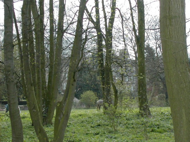
 To the west of the hall, the lane joins the lane from the Leeds-York Road (the A64) at Kiddal to Barwick-in-Elmet. The photographs (taken on 13th April 2002) show two views of the junction of the two lanes at Morgans Cross on a spring day. The origin of the name Morgans Cross is obscure and has been the subject of creative speculation in the past. The field where the white horse is grazing bears traces of long lost buildings which may throw some light on the puzzle if it is surveyed at some future date.
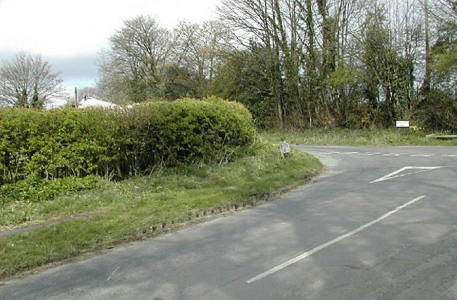 It lies near Potterton Grange which had a monastic pottery at the close of the middle ages. The seat on the extreme right in the second picture provides a useful resting place.
To the south of Potterton is a lane, Miry Lane, (an apt description after heavy rain) which is a bridle path leading to Leyfield Farm and Aberford. Some 300 metres south of Potterton there are extensive views towards Barwick-in-Elmet and west to Scholes and further.
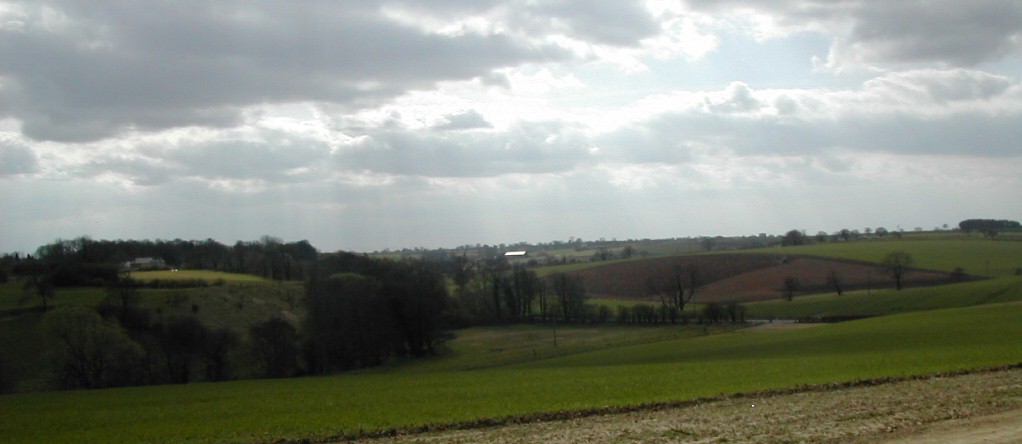
Photographed on the 12th April 2002, the edge of Barwick can be seen on the left. The trees behind the building on the edge of the village are growing on the banks of the village's iron age earthworks. In the centre of the view a barn roof at Rakehill Farm shines across the landscape. In the distance lies Scholes and beyond that the Stanks and Whinmoor housing development of Leeds. The small bumps on the horizon above the field which is being ploughed are the blocks of flats in this development. In the valley below the Raike Beck flows eastwards. Behind the large trees in the valley the road from Potterton crosses the beck at the Potterton Bridge.